This is a series showing the behind the scenes of a one-person side project that sold a physical product and built a brand identity -- a journey that includes 3D printing, bronze casting, 40+ interviews with amazing climbers/runners/hikers, 50 retail shops, and a whole lot of learning.
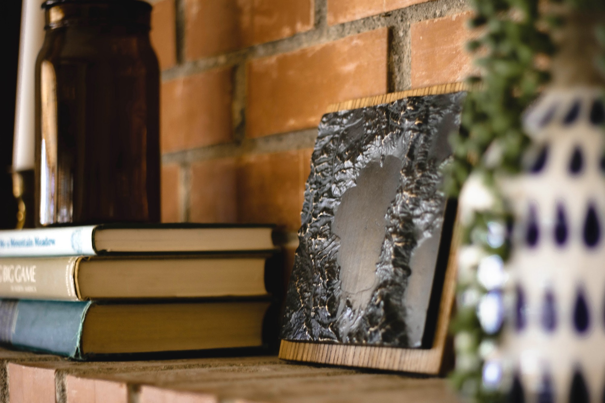
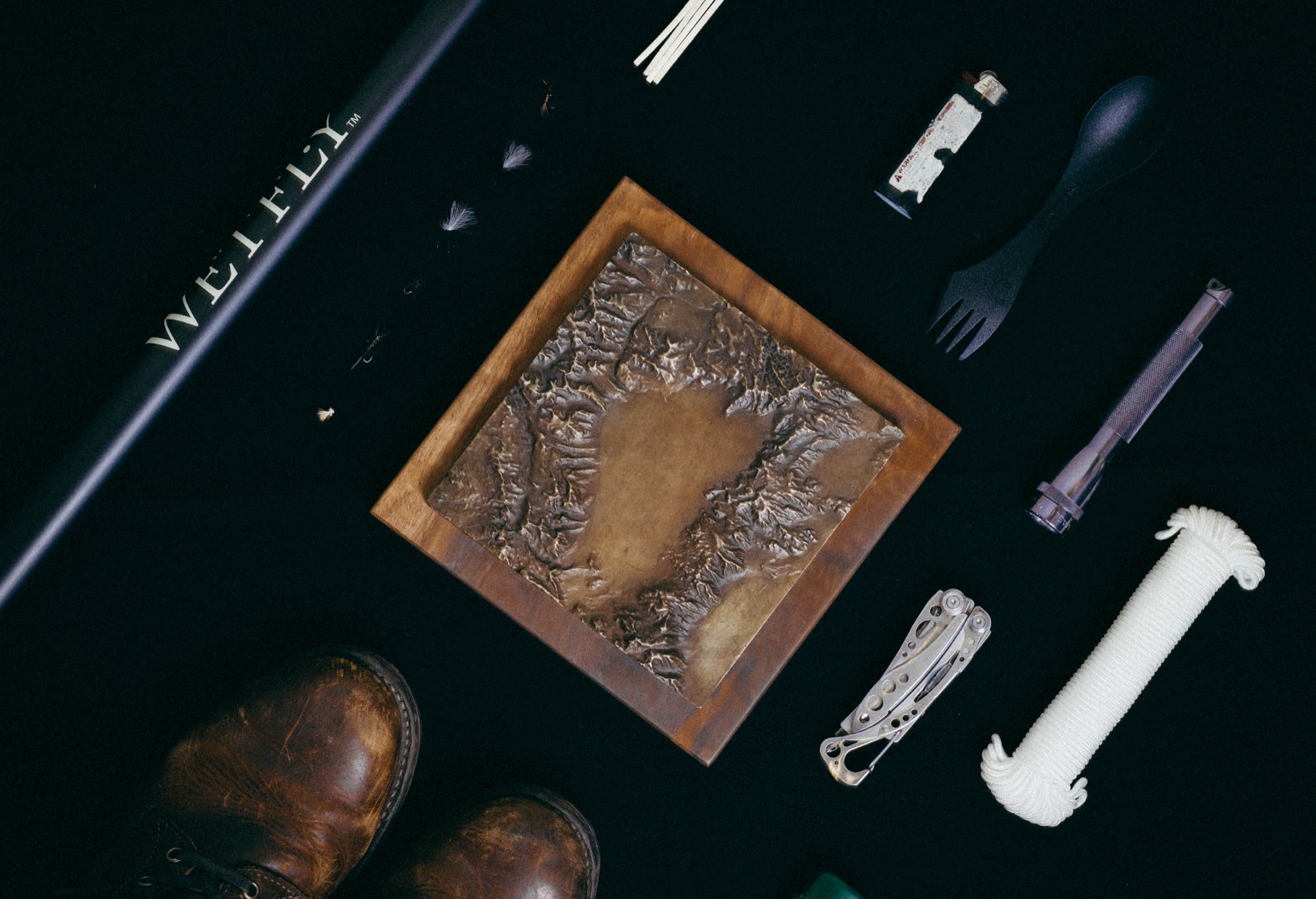
Who am I? My name is Greg Kamradt and I am the founder of Terra Mano. We make handcrafted maps of American landscapes. Think 3D printed mountains cast in bronze geared towards outdoor athletes and mountainous vacation goers.
One of the reasons I picked up this project was to try something I knew nothing about. A few people have asked about this process so I wanted to write it out for others. This post is what I would have liked to read at the beginning of the journey.
This is part 1 of a 4 part series:
**Part #1: Selling 3D Bronze Maps - Idea Generation + Validation
****Part #2: Making My Way Through Manufacturing: 3D Printing + Bronze Casting
****Part #3: Behind The Scenes: Brand Identity (Logo, Photography) & Admin Tasks (Tools Used, Automation)
**Part #4: Sales: Trying To Sell A Physical Product From Scratch
In this post, I will talk about how I came up with the idea and did quick market validation. In later posts I will dive into the details of what it took to get this off the ground and the mistakes I made.
A Bit Of Context
Here is our Lake Tahoe Bronze
My project goals:
Work on something physical - This was to take my head out of the abstract tech world, even for a brief while
Put good energy into something - I’ve puttered around with a few side projects in the past which I put a 20% effort into. My goal this time was to at least get a couple sales and build something I was proud of.
What I didn’t want to do
- Try and hit a homerun with a money maker - Sure revenue generation would be nice, but making a ton money wasn’t the top priority
I went at this project as a big experiment. I knew better than to think this was going to automatically work. With that in mind, I kept my costs down, and spent my energy on high leverage activities.
Let’s get into it…
What we’ll cover:
Idea Generation
Lake Tahoe Wood Maps
1 Hour Research Session
What is being produced and served to the market today?
Competition - Am I The First? Or is the market saturated?
Could I complete an MVP with low capital requirements?
What is the potential market size?
Results & Decision - Should I move forward?
TL;DR: I saw the success of Lake Tahoe Wood Maps and wanted to go after this same market, but with a twist on the type of product. I decided to compete on quality vs price. I researched and couldn’t find anyone doing it yet, so I decided to give it a try.
Idea Generation
Ah, the questions that start all good projects. “What should I do?”
I was in Bali and knew I wanted to put energy into a side project. My goal was to get my wheels turning. While making a huge profit would have been nice, again it wasn’t my top priority.
For too long I told myself I wanted to start a business and I knew that it would just take a little bit of energy. I mean, what is starting a business anyway?
Over the years I’ve written down random ideas that loosely followed James Altucher’s “10 Ideas.”
The gist is basically, “You can’t think of 1 idea? Ok, then think of 10 ideas” You need to lower your bar for what is an “idea” and just word vomit things out. This usually leads to fun creativity.
If you want to see 50+ ideas I’ve had over the years check out these posts: 1, 2, 3, 4, 5. Warning: They were written by an energetic young 20s-something.
Lake Tahoe Wood Maps
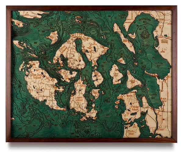
One of the ideas I had was to jump on to the “Lake Tahoe Wood Map” market.
For those who don’t know, Lake Tahoe Wood Maps are wood layered maps that show the under water elevation of an area. Fun Fact: Bathymetry shows underwater elevation while topography usually shows above ground elevation.
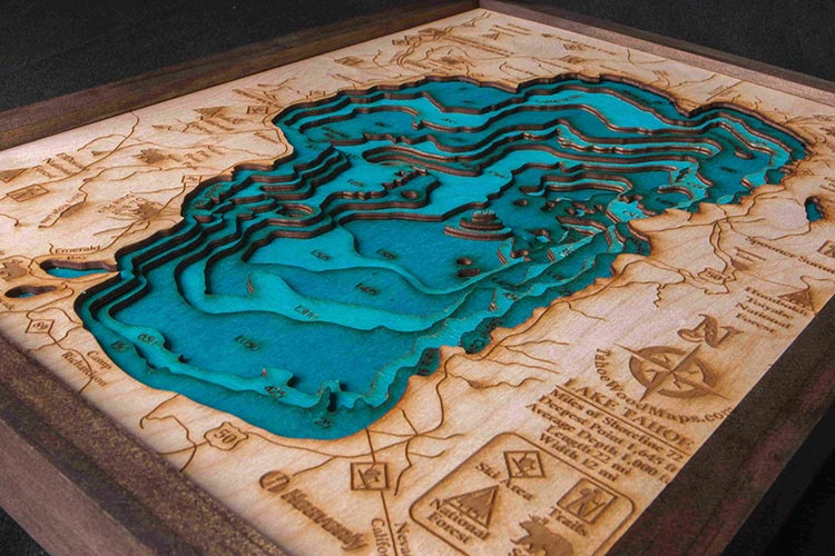
I saw them popping up all over stores, cabins, and friend’s homes.
But then I said to myself, “Underwater elevation is great, but I’m a mountain person, I want to see the topographic model of mountainous areas. Even better, specific mountains I’ve climbed.”
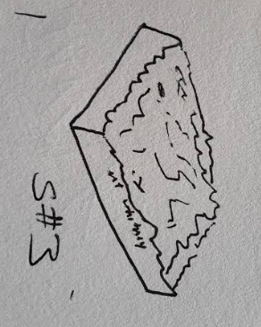
Here is my very first sketch of what I saw in my head. A simple base with the terrain of a mountain region on top.
This idea gave me “what-if” enough energy to start a “1 Hour Research Session.” Was anyone already doing this? I wanted to find out
1 Hour Research Session
My hypothesis to research: The market would sustain a 1-person business producing a quality, elevated mountain decor piece geared towards hikers/climbers/trail runners/and 2nd-home rustic cabin owners.
Whenever I’m excited about a hypothesis, I like to do a 1 Hour Research Session. This is an hour of focused time to explore, challenge, and learn about whatever you’re curious about.
Here are the questions from my session. If you’re curious about the answers, keep reading, if not skip down to the results.
What is being produced and served to the market today?
What is the brand voice these companies are taking towards their market?
Are there enough competitors that validate money is being made, but not enough that the market is too saturated?
From a manufacturing perspective, could I complete an MVP with low capital requirements?
What is the vocabulary used in the industry?
What is the potential market size?
What is being produced and served to the market today?
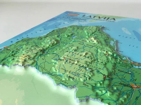
I saw two big categories of 3D map products 1) Artistic and 2) Scientific
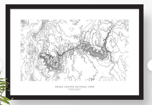
Artistic maps appealed to the homeowner who wanted a decor item. These were most often framed wood maps that had different wood layers built on top of them or typographic posters. They’re awesome and beautiful.
For wood maps I saw players like, Tahoe Wood Maps, Nautical Wood Maps, or Woodscape Maps.
For topographic artsy posters I saw, Muir Way and Topographia
Scientific maps are geared towards educational and research purposes. They are used as tools to accurately display information. Generally they are colored, and use a method called “Vacuum forming” to get their shape.
Here’s a list of 32 players either making or selling these types of map products that I found during my search.
Lastly, if you want to geek out on these maps even more, check out Physical 3D Maps: The Ultimate Guide on the Terra Mano website.
What is the voice or angle these companies are taking towards their market?
I saw the voice of the market was either 1) light hearted and colorful, or 2) dry scientific.
I didn’t see anyone gearing their products towards the mountain climber, hiker, or rustic cabin owner. This was a positive sign for the market I was trying to go after.
Are there enough competitors to validate that money is being made, but not enough that the market is too saturated?
Yes, I validated that there were enough market players to sustain a 1 person business. It is a good thing when there is competition out there.
If no one was doing this that either means 1) I’m the first to a new market or 2) there isn’t any money to be made. Usually it’s the latter.
From a manufacturing perspective, could I complete an MVP with low capital requirements?
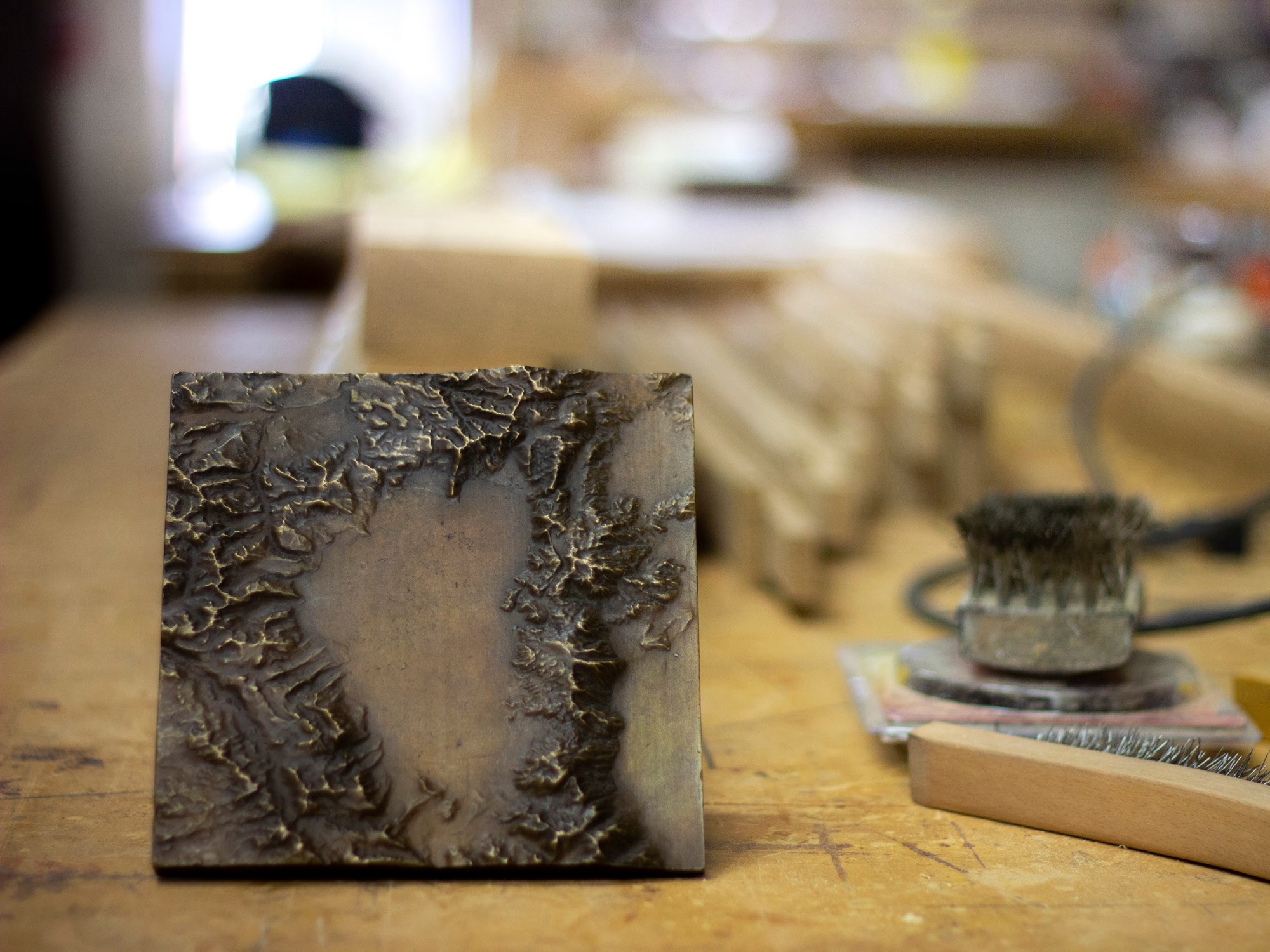
I wanted a realistic piece, without layer lines -- horizontal lines that show up on most 3D prints. I chose 3D printing to produce the model. To get the quality feel, I went with a bronze casting route for the finished product. This would be expensive, but I wasn’t trying to compete on price. I wanted cool products that I was excited about.
I found getting a 3D print, which could be repurposed to make 100s of bronzes, would cost around $50. Getting a bronze done was anywhere from $80-$200 / unit. I figured these prices were fine while I was testing an idea out.
I decided that if the project took off, I would try to optimize these costs. No need to worry about it now during testing mode.
What is the vocabulary used in the industry?
It’s good to get an understanding of the nomenclature and language of the new world you’re trying to enter. Here are the key words that quickly became important to me:
Raised Relief Map - A raised-relief map or terrain model is a three-dimensional representation, usually of terrain, materialized as a physical artifact
Digital Elevation Model - Basically digital elevation data for 3D programs to read
Lost Wax Casting - Method of metal casting in which a molten metal is poured into a mold that has been created by means of a wax model
Bronze - An alloy that consists primarily of copper with the addition of other ingredients
Vertical Exaggeration - Stretching mountains up while you’re 3D modeling to produce a dramatic look or to highlight features
Stereolithography 3D Printing - Basically using flashing lasers to harden resin which results in a physical 3D print.
Global Information System (GIS) - Computer-based information system that performs the activities of capturing, storing, manipulating, analyzing and displaying both spatial and non-spatial data.
What is the potential market size? What are the trends?
My product was a mountain home decor piece. This would be geared towards cabins or city dwellers who wanted to “bring the mountains home.”
Looks like $800B as the total size of the global home market.This number is huge, but my slice of the pie is super small.
Honestly, I had a hard time deriving a believable market size for me in that $800B so I went about it another way.
Get ready for a consultant style market size analysis:
6,723 - # Vacation homes in Tahoe (via vrbo)
13,446 - # Vacation homes in Tahoe including those not listed on vrbo (assuming 2x)
53,784 - Households filled with people who love Lake Tahoe and likely have a decor piece (assuming 3x the number of vacation homes in Tahoe) ex: San Francisco families who vacation in Tahoe
268 units sold / year - 53,784 Total Homes * .5% market share sold to a year.
$67,000 Revenue for Tahoe / Year - 268 units sold a year * $250 unit price
~$1M Revenue a year once ramped up - Assuming 15 locations supported.
$~1M seemed alright for now. Hopefully there would be upside to some of the assumptions I made. But usually it goes the other way around.
The Hobbyist Hypothesis
Another truth I believe is: If there are hobbyists passionate about an idea, there is space for a business to provide value through automation, economies of scale, and organization.
That’s a long way of saying, if people are rallying around your idea for fun, there is potential to rally around your idea as a business.
Similar to when computers were just starting and Homebrew Computing Club was sharing ideas.
I saw a ton of energy on youtube for people making 3D topographic mountains. However, they always kept it as the hobbyist level. Check out this Everest video or this Printing Cities video to see what I’m talking about.
Results
After digging around for a while I answered a few of my questions
Yes, there were people buying location based art pieces
No, there weren’t any players with the mountain rustic voice I was planning
No, there wasn’t anyone making bronze mountains
Most importantly - Yes, I was still having fun researching and putting energy into this idea.
The decision: Take the next step and see what you can do. I went down the path of manufacturing: getting the data, making a 3D model and ultimately a finished product.
Learn about this entire process on Post #2: Making My Way Through Manufacturing: 3D Printing + Bronze Casting
Sign up here to get this post delivered directly to your inbox.